Natchez, MS to New Roads, LA
Tuesday, October 14, 2003
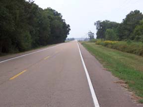
Well, it was back to 6:00 AM wake up this morning. We walked to breakfast at the motel in the dark and when we started to ride the bicycle at 7:00 AM, it was still dark enough that we needed to turn on our flashing rear lights. We again headed for downtown Natchez but when we came to the intersection where we turned right to go to the historic downtown district, we went straight, headed for the bridge to Vidalia, LA. The west bound bridge did not have any bicycle lanes so at the last intersection before the bridge we turned left and went down the shoulder against the traffic to the east bound bridge. The good news was that the shoulder was at least 8 feet wide and it continued that wide all the way across the bridge until we came to the first intersection on the Louisiana side. We turned onto the road going south and never looked back. For the first 2 or 3 hours we had a light headwind and Becky tucked in behind our bicycle and drafted. She said that drafting let her heart beat drop and her speed increase by 2 miles per hour. The road today was very, very flat once we reached Louisiana. We climbed 95 feet in the first 4 miles getting to Louisiana and we only climbed another 100 feet in the next 80 miles. The only time we climbed after we reached Louisiana was when we left the flood plain and climbed onto the Levee that protects the Louisiana flood plain from the Mississippi River. The roads were also very straight and we would go 2 to 4 miles between turns.
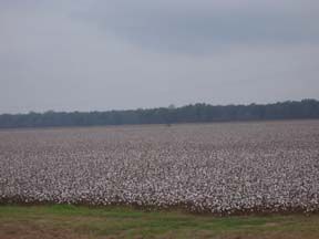
 At the start of our ride, we had cotton fields and/or woods on both sides of the road. We rode by several cotton fields that had not been picked, and the color of the white cotton dominated. In the distance background we could see a cotton picking machine going down the long rows of cotton.
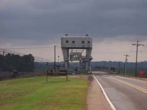
 After we had traveled 45 miles we came to a series of old structures that were built by the US Corp of Engineers to control the Mississippi flood waters. They consisted of a series of three dam like structures that were designed to let Mississippi River water flow into a large low lying area west of the Mississippi River.
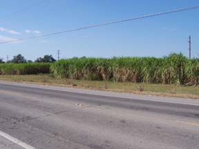
 As we approached the town of Morganza, LA we began to see truck after truck hauling what looked like short sticks about one foot long. These sticks were sugar cane and the further south we got the more of these trucks we saw. Finally as we approached New Roads we saw an actual sugar cane field.
 In the afternoon we were helped to our destination by a good tailwind. At Morganza, we saw some flags that the wind held straight out. The wind and the flat roads helped us get through this long day without being totally exhausted. We reached our motel for the night, cleaned up, |
Return
Last modified 10/15/03